
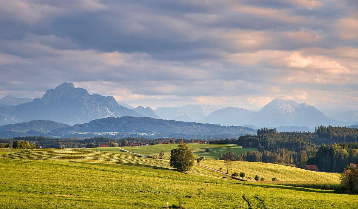
Safe Fell Walking for Complete Beginners
Why the Fells Are a Different Country
A gentle walk through lowland woods or along a Devon lane rarely asks much of you. An upland day out is a different bargain altogether. In the Lake District, Snowdonia, the Pennines or the Scottish Highlands, the ground can rise 600 metres or more in a few kilometres, the path can vanish beneath loose scree, and weather that looks friendly from the valley car park can turn into driving rain and 60mph gusts within the hour. That is not a reason to stay away. It is a reason to treat your first fell days as a skill to be learned, in the same way you would approach climbing or kayaking.
Most mountain rescue callouts involve people who were perfectly fit but poorly prepared: no map, no compass, no torch, and a route chosen from a photograph rather than a contour line. Get the basics right and the fells open up wonderfully.
Choose a Route That Fits the Shortest Day
Plan for the daylight you will actually have, not the daylight there will be at midday. Aim for 8 to 12 kilometres with no more than 500 metres of ascent on your first outing, and be honest about your pace. A common rule of thumb is one hour for every 4 kilometres, plus one hour for every 600 metres of climbing, with an extra half-hour for a group of four or more. Add time for stops, photographs and the inevitable faffing with layers.
Look for a route with clear escape options:
- A valley path that follows a stream, so you can turn back at any point without retracing a ridge.
- A summit reached by one path and descended by another — a circuit is far more rewarding than an out-and-back.
- Paths drawn on the map as a firm line rather than a dotted "path may be indistinct" symbol.
- A car park, bus stop or hamlet near the halfway point, in case someone has had enough.
Read a guidebook or a local route description before you go. Choose something graded easy or moderate, and resist the temptation to start with a classic horseshoe.
Check the Forecast, Then Check It Again
Hill forecasts are not the same as the one on the evening news. Look specifically for a mountain or fell-top forecast, which gives wind speed at summit level, cloud base and the likelihood of rain. Wind is what catches beginners out: a steady 40mph on an exposed ridge will push you off your feet and make speech impossible.
Pay attention to:
- Cloud base. If it is forecast below the summits, assume you will be navigating in mist and plan accordingly.
- Wind speed and direction. Anything above 40mph on high ground means choosing a low-level route instead.
- Temperature and wind chill. A still 8°C in the valley can feel like minus 5°C on a windy top.
- Daylight. Know your sunset time and subtract an hour of buffer.
If the forecast is poor, change the plan rather than the ambition. A low-level circuit in the rain is still a good day out.
The Kit That Matters Most
You do not need expensive gear to start, but a few things should be non-negotiable.
- A paper map and a compass — and the knowledge to use them. A 1:25,000 scale map shows walls, streams and field boundaries clearly; a 1:50,000 is lighter but demands more care.
- Waterproof jacket and trousers, not just a showerproof shell. Breathable fabrics are worth the money.
- Boots with a proper sole that grip wet rock and grass. Trainers are fine on lowland paths, not on steep, greasy fellside.
- Layers: a base layer, a fleece or mid-layer, and a spare warm layer in the rucksack even in summer.
- A head torch with spare batteries, plus a whistle and an emergency shelter or foil blanket.
- Food and water for the whole day, plus a little extra.
Charge your phone, but treat it as a backup. Batteries die in the cold, signal vanishes in valleys, and a screen is no substitute for a map you can read in the rain.
Learn to Navigate Before You Need To
Navigation is a set of small skills, and each one can be learned on a lowland walk before you take it uphill.
- Orient the map using the compass and the terrain around you, so features on the ground line up with features on the paper.
- Follow a handrail — a wall, stream or ridge line running in the direction you want to go, keeping you on track without constant checking.
- Take a bearing and walk on it, counting your paces to estimate distance.
- Identify catching features — a road, a lake or a fence line that will stop you if you overshoot.
- Practise in mist or darkness on familiar ground, so the skills are already there when conditions turn.
Use them on short walks until they feel automatic. If in doubt, stop, take your time and work out exactly where you are before moving on.
On the Day: Tell Someone, and Turn Back Early
Leave a written plan with someone at home: your route, your expected finish time, and what to do if you have not been in touch by then. Text them when you set off and when you are back at the car. Carry a charged phone, but remember that signal is patchy; in an emergency, dial 999 or 112 and ask for the police, then mountain rescue.
Finally, give yourself permission to turn back. The summit will still be there next year. A cold, wet, tired group descending a path they can no longer follow is how a lovely day becomes a rescue statistic. Turning around while you are still enjoying yourself is not failure — it is the single most useful judgement a fell walker ever learns.
tag: Walks

James Hartley Author
Choose seeds, nuts and fats for different species, position feeders safely and keep them clean to prevent disease.
YOU MAY ALSO LIKE

Setting Up a Bird Feeder Station
Aug 15
10Veteran oaks and yews host rare fungi, insects and bats; support local campaigns to safeguard these living monuments.
read more
Why Ancient Trees Need Our Protection
Aug 13
10Identify safe wild edible plants, always harvest responsibly and make simple soups or pestos without damaging woodland populations.
read moreWildlife
-

ERRIC CATONA
Soft ground reveals footprints of deer, foxes and badgers; use field guides to identify prints and learn their routines.
May 19, 2016 at 5.12 pm
Reply
ERRIC CATONA
These natural engineers create wetlands that reduce flooding and boost biodiversity, though their return often sparks local debate.
May 19, 2016 at 5.12 pm
Reply -
ERRIC CATONA
Install local bat boxes, reduce light pollution and plant native night-scented flowers to help these protected mammals thrive.
May 19, 2016 at 5.12 pm
Reply
Countryside
Your email address will not be published.